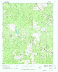
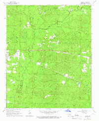
1970 Map of Hardin
USGS Topo · Published 1972About this map
Hardin and the surrounding townships of Jefferson, Washington, and Darysaw represent a crossroads of rural settlement and industrial presence in the early 1970s. The landscape is defined by its water system, where Bartholomew Bayou and Caney Bayou drain the eastern plains while the complex creek network of Derrieusseaux Creek and East Fork carves through the western hills. The northeastern corner is notably dominated by the Pine Bluff Arsenal and the Missouri Pacific RR, illustrating the intersection of military logistics and rail infrastructure that influenced local development.
Find a feature on this map
50 named features on this map. Tap any name to fly to it.
Don’t see what you’re looking for? This feature index may not catch every label — zoom into the map to look around manually.
Map Details
Editions of this 1970 Hardin Map
4 editions found
Other maps of this area

1932 · Pastoria
USGS Topo · 1:62,500

1935 · Pastoria
USGS Topo · 1:62,500

1955 · Little Rock
USGS Topo · 1:250,000

1956 · Little Rock
USGS Topo · 1:250,000

1960 · Little Rock
USGS Topo · 1:250,000

1962 · Pine Bluff
USGS Topo · 1:24,000

1962 · Pine Bluff NW
USGS Topo · 1:24,000

1964 · Little Rock
USGS Topo · 1:250,000

1964 · Cane Creek
USGS Topo · 1:24,000
1964 · Prague
USGS Topo · 1:24,000