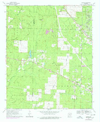
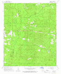
1970 Map of Hardin
USGS Topo · Published 1978About this map
The border of Grant and Jefferson counties defines this 1970s landscape, where small rural communities are connected by a network of historic thoroughfares like Monticello Road and June Road. The Missouri Pacific RR cuts diagonally through the northeast, serving the settlement of Hardin and passing near the Pine Bluff Arsenal boundary. This era shows a transition in land use, with several areas marked as under construction near Caney Creek and significant revision data from 1975 photogrammetry. Genealogists will find a high density of burial sites and rural congregations, including New Shiloh Ch, Old Shiloh Cem, and Hardin Cem. The hydrological character of the region is dominated by the winding paths of Bartholomew Bayou and Derrieusseaux Creek, which provide drainage for the low-lying timber and agricultural lands surrounding Doylestown and Midway.
Find a feature on this map
54 named features on this map. Tap any name to fly to it.
Don’t see what you’re looking for? This feature index may not catch every label — zoom into the map to look around manually.
Map Details
Editions of this 1970 Hardin Map
4 editions found
Other maps of this area

1932 · Pastoria
USGS Topo · 1:62,500

1935 · Pastoria
USGS Topo · 1:62,500

1955 · Little Rock
USGS Topo · 1:250,000

1956 · Little Rock
USGS Topo · 1:250,000

1960 · Little Rock
USGS Topo · 1:250,000

1962 · Pine Bluff
USGS Topo · 1:24,000

1962 · Pine Bluff NW
USGS Topo · 1:24,000

1964 · Little Rock
USGS Topo · 1:250,000

1964 · Cane Creek
USGS Topo · 1:24,000
1964 · Prague
USGS Topo · 1:24,000