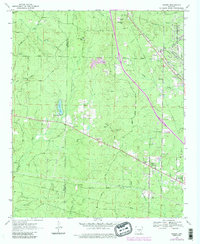
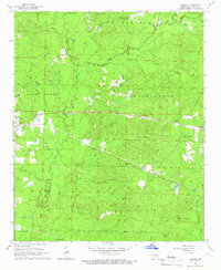
1970 Map of Hardin
USGS Topo · Published 1984About this map
Bartholomew Bayou and Caney Bayou meander through the eastern reach of this Jefferson County landscape, where the Pine Bluff Arsenal occupies a significant tract of land. The settlement of Hardin serves as a local hub, connected by the Missouri Pacific RR which cuts diagonally across the terrain near Samples. The map captures a transition from the structured military grounds in the east to the more dispersed rural communities of Doylestown and Midway toward the west.
Find a feature on this map
48 named features on this map. Tap any name to fly to it.
Don’t see what you’re looking for? This feature index may not catch every label — zoom into the map to look around manually.
Map Details
Editions of this 1970 Hardin Map
4 editions found
Other maps of this area

1932 · Pastoria
USGS Topo · 1:62,500

1935 · Pastoria
USGS Topo · 1:62,500

1955 · Little Rock
USGS Topo · 1:250,000

1956 · Little Rock
USGS Topo · 1:250,000

1960 · Little Rock
USGS Topo · 1:250,000

1962 · Pine Bluff
USGS Topo · 1:24,000

1962 · Pine Bluff NW
USGS Topo · 1:24,000

1964 · Little Rock
USGS Topo · 1:250,000

1964 · Cane Creek
USGS Topo · 1:24,000
1964 · Prague
USGS Topo · 1:24,000