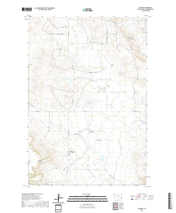
2021 Map of Harding
USGS Topo · Published 2021About this map
Harding occupies a high-plains landscape in Northwest South Dakota, defined by the erosion-carved breaks of the Little Grand River basin. The area's verticality is most pronounced at The Jumpoff, where the land drops away toward the river, and along the eastern slopes of the West Short Pine Hills. These features create a complex drainage network where Valley Cr, Waterhole Cr, and Brush Cr navigate the terrain alongside numerous dry channels like Dodge Draw and Sand Coulee.
Find a feature on this map
24 named features on this map. Tap any name to fly to it.
Don’t see what you’re looking for? This feature index may not catch every label — zoom into the map to look around manually.
Map Details
Editions of this 2021 Harding Map
This is the sole edition of this map. No revisions or reprints were ever made.
Other maps of this area

1935 · Harding
USGS Topo · 1:125,000

1935 · Buffalo
USGS Topo · 1:125,000

1954 · Lemmon
USGS Topo · 1:250,000

1957 · Lemmon
USGS Topo · 1:250,000

1971 · Saddle Butte
USGS Topo · 1:24,000

1973 · Bog Creek
USGS Topo · 1:24,000

1973 · Hells Canyon
USGS Topo · 1:24,000

1974 · Pine Spring
USGS Topo · 1:24,000
1977 · Harding
USGS Topo · 1:24,000
1977 · Camp Crook
USGS Topo · 1:24,000