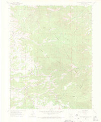
1963 Map of Hardscrabble Mountain
USGS Topo · Published 1972About this map
San Isabel National Forest dominates this 1963 survey of Custer County, showing a landscape defined by its complex drainage network and high-elevation terrain. The map records the rural community structure before modern development, centered around small outposts like Ilse and McKenzie Junction. Significant local-history landmarks are documented, including the Silver Park Sch near Silver Park Creek, providing evidence of the area's early educational and social hubs. The topography is anchored by major peaks such as Hardscrabble Mountain, Stull Mountain, and Adobe Peak. A clear network of paths like the Highline Trail and various Pack Trails weave through the gulches, illustrating how miners and ranchers navigated the steep grades of Lead Mountain and Rudolph Mountain during the mid-20th century.
Find a feature on this map
49 named features on this map. Tap any name to fly to it.
Don’t see what you’re looking for? This feature index may not catch every label — zoom into the map to look around manually.
Map Details
Editions of this 1963 Hardscrabble Mountain Map
3 editions found
Other maps of this area

1889 · Canon City
USGS Topo · 1:125,000

1892 · Canon City
USGS Topo · 1:125,000

1954 · Mount Tyndall
USGS Topo · 1:24,000

1954 · Rosita
USGS Topo · 1:24,000

1954 · Pueblo
USGS Topo · 1:250,000

1957 · Pueblo
USGS Topo · 1:250,000

1958 · Pueblo
USGS Topo · 1:250,000

1959 · Rockvale
USGS Topo · 1:24,000

1959 · Royal Gorge
USGS Topo · 1:62,500
1959 · Florence SE
USGS Topo · 1:24,000