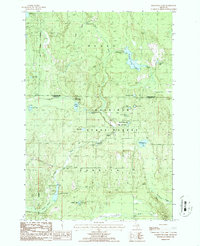
1986 Map of Hardwood Lake
USGS Topo · Published 1986About this map
The Pigeon River carves a central path through this mid-1980s landscape at the boundary of Cheboygan Co and Otsego Co. This area is defined by its extensive public lands, where the Mackinaw State Forest, Nunda State Forest, and Corwith State Forest converge. The terrain is marked by numerous glacial kettle lakes and basins, including the aptly named Devils Bowl Lake and the Paul Bunyan Punch Bowl.
Find a feature on this map
29 named features on this map. Tap any name to fly to it.
Don’t see what you’re looking for? This feature index may not catch every label — zoom into the map to look around manually.
Map Details
Editions of this 1986 Hardwood Lake Map
2 editions found
Other maps of this area

1954 · Gaylord
USGS Topo · 1:62,500

1954 · Hetherton
USGS Topo · 1:62,500

1955 · Cheboygan
USGS Topo · 1:250,000

1957 · Tower
USGS Topo · 1:62,500

1957 · Wolverine
USGS Topo · 1:62,500

1958 · Cheboygan
USGS Topo · 1:250,000

1982 · Petoskey
USGS Topo · 1:100,000

1986 · Silver Lake
USGS Topo · 1:24,000
1986 · Saunders Creek
USGS Topo · 1:24,000
1986 · Tower
USGS Topo · 1:24,000