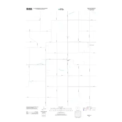
2013 Map of Hardy
USGS Topo · Published 2013About this map
The small settlement of Hardy serves as the central hub of this agricultural landscape in Humboldt County, situated at the intersection of Clinton Ave and 165th St. The map reveals a strictly organized section-line road grid, characteristic of the Iowa plains, where long-distance routes like Virginia Ave and Texas Ave define the movement of goods and people between farmsteads.
Find a feature on this map
27 named features on this map. Tap any name to fly to it.
Don’t see what you’re looking for? This feature index may not catch every label — zoom into the map to look around manually.
Map Details
Editions of this 2013 Hardy Map
This is the sole edition of this map. No revisions or reprints were ever made.
Other maps of this area

1923 · Fort Dodge
USGS Topo · 1:62,500

1954 · Waterloo
USGS Topo · 1:250,000

1954 · Fort Dodge
USGS Topo · 1:250,000

1955 · Waterloo
USGS Topo · 1:250,000

1957 · Fort Dodge
USGS Topo · 1:250,000

1958 · Fort Dodge
USGS Topo · 1:250,000

1972 · Corwith
USGS Topo · 1:24,000

1972 · St. Joseph
USGS Topo · 1:24,000

1972 · Renwick
USGS Topo · 1:24,000
1972 · Lu Verne
USGS Topo · 1:24,000