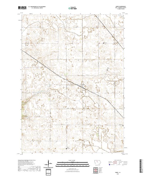
2022 Map of Hardy
USGS Topo · Published 2022About this map
Hardy serves as the central hub for this rural Humboldt County landscape, where the town's grid of residential streets like 3rd St and 165th St sits amidst a vast network of section-line roads. The terrain is defined by its agricultural utility, evidenced by the significant engineering of Drainage Ditch Number 4 which cuts through the township towards the west. This modified water system highlights the transformation of the Iowa prairie into productive farmland during the 20th century.
Find a feature on this map
35 named features on this map. Tap any name to fly to it.
Don’t see what you’re looking for? This feature index may not catch every label — zoom into the map to look around manually.
Map Details
Editions of this 2022 Hardy Map
This is the sole edition of this map. No revisions or reprints were ever made.
Other maps of this area

1923 · Fort Dodge
USGS Topo · 1:62,500

1954 · Waterloo
USGS Topo · 1:250,000

1954 · Fort Dodge
USGS Topo · 1:250,000

1955 · Waterloo
USGS Topo · 1:250,000

1957 · Fort Dodge
USGS Topo · 1:250,000

1958 · Fort Dodge
USGS Topo · 1:250,000

1972 · Corwith
USGS Topo · 1:24,000

1972 · St. Joseph
USGS Topo · 1:24,000

1972 · Renwick
USGS Topo · 1:24,000
1972 · Lu Verne
USGS Topo · 1:24,000