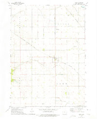
1972 Map of Hardy
USGS Topo · Published 1975About this map
The town of Hardy serves as the focal point of this Humboldt County landscape, situated at the junction of the Chicago Rock Island and Pacific railroad and local rural roads. The area is defined by its organized agricultural layout, where township lines separate Vernon, Lake, and Grove. Local history is preserved in the placement of community landmarks like Vernon Sch, Swiss Cem, and Township Cem, which dot the sections surrounding the main settlement.
Find a feature on this map
19 named features on this map. Tap any name to fly to it.
Don’t see what you’re looking for? This feature index may not catch every label — zoom into the map to look around manually.
Map Details
Editions of this 1972 Hardy Map
This is the sole edition of this map. No revisions or reprints were ever made.
Other maps of this area

1923 · Fort Dodge
USGS Topo · 1:62,500

1954 · Waterloo
USGS Topo · 1:250,000

1954 · Fort Dodge
USGS Topo · 1:250,000

1955 · Waterloo
USGS Topo · 1:250,000

1957 · Fort Dodge
USGS Topo · 1:250,000

1958 · Fort Dodge
USGS Topo · 1:250,000

1972 · Corwith
USGS Topo · 1:24,000

1972 · St. Joseph
USGS Topo · 1:24,000

1972 · Renwick
USGS Topo · 1:24,000
1972 · Lu Verne
USGS Topo · 1:24,000