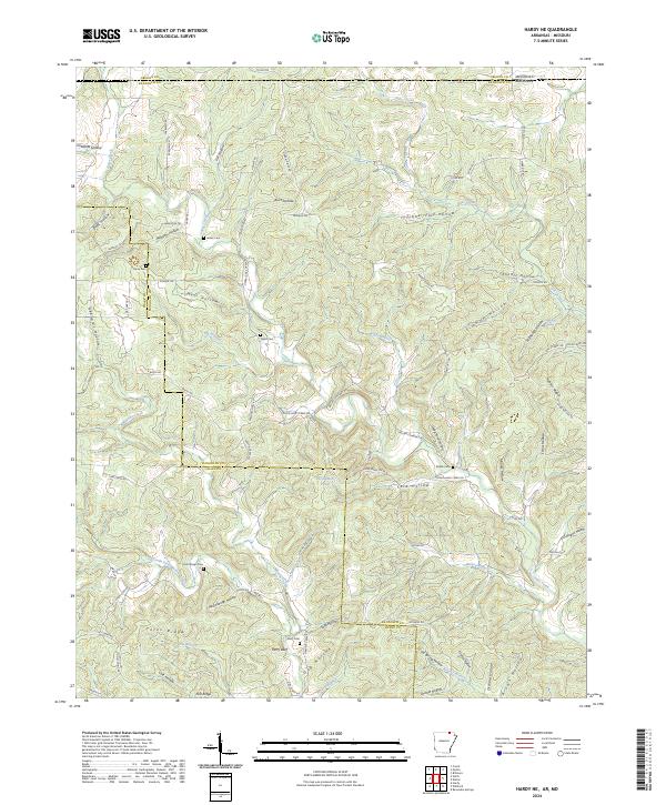
2024 Map of Hardy NE
USGS Topo · Published 2024About this map
Janes Creek and Martins Creek flow through this section of the Ozark foothills, where the Arkansas-Missouri state line meets the boundary between Randolph and Oregon counties. The landscape is defined by an intricate network of narrow valleys such as Koontz Hollow, Stillhouse Hollow, and Muntz Hollow, leading down from ridges like Yates Ridge. Settlement patterns are recorded through a high density of small family burial grounds, including Bellah Cem, James Cem, and McCollough Cem, which serve as critical markers for genealogical research in this rural borderland. Notable geographical landmarks include the riverfront site of Perry Bluff and the waters of Persimmon Pond, while local infrastructure is represented by a series of winding timber and ridge roads like Nubbin Ridge Rd and Bellah Cematary Rd.
Find a feature on this map
91 named features on this map. Tap any name to fly to it.
Don’t see what you’re looking for? This feature index may not catch every label — zoom into the map to look around manually.
Map Details
Editions of this 2024 Hardy NE Map
This is the sole edition of this map. No revisions or reprints were ever made.
Other maps of this area

1941 · Gatewood
USGS Topo · 1:62,500

1944 · Couch
USGS Topo · 1:62,500

1945 · Gatewood
USGS Topo · 1:62,500

1946 · Couch
USGS Topo · 1:62,500

1957 · Poplar Bluff
USGS Topo · 1:250,000

1959 · Poplar Bluff
USGS Topo · 1:250,000

1960 · Poplar Bluff
USGS Topo · 1:250,000

1966 · Ravenden Springs
USGS Topo · 1:24,000
1966 · Billmore
USGS Topo · 1:24,000

1968 · Hardy
USGS Topo · 1:24,000