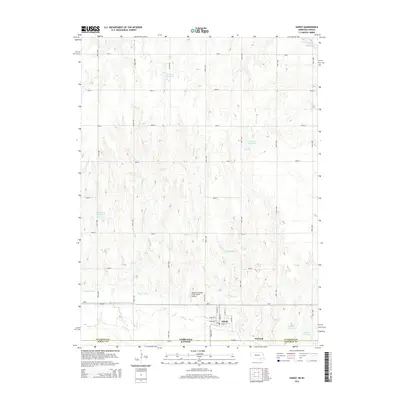
2014 Map of Hardy
USGS Topo · Published 2014About this map
Hardy, Nebraska, sits directly on the state line, its grid of streets such as Main St and Market St ending abruptly at the border with Kansas. The agricultural landscape is defined by a dense network of local section roads, including Road J and Road 4000, which navigate the drainages of Forsha Cr and Crosby Cr. Water management is a central theme of this 2014 survey, with the Superior Canal cutting across the southern terrain and numerous private water bodies like Simonsen Reservoir and Jensen Reservoir scattered throughout the north. Near the state line, the Meyers Freedom Flight Hardy Airport serves as a local aviation landmark just north of Ne-8. The map also captures the small community of Warwick to the east, illustrating the cross-border connectivity between Nuckolls, Republic, and Jewell counties.
Find a feature on this map
42 named features on this map. Tap any name to fly to it.
Don’t see what you’re looking for? This feature index may not catch every label — zoom into the map to look around manually.
Map Details
Editions of this 2014 Hardy Map
This is the sole edition of this map. No revisions or reprints were ever made.
Other maps of this area

1892 · Concordia
USGS Topo · 1:125,000

1894 · Mankato
USGS Topo · 1:125,000

1898 · Superior
USGS Topo · 1:125,000

1898 · Hebron
USGS Topo · 1:125,000

1955 · Manhattan
USGS Topo · 1:250,000

1955 · Lincoln
USGS Topo · 1:250,000

1955 · Grand Island
USGS Topo · 1:250,000

1955 · Beloit
USGS Topo · 1:250,000

1956 · Manhattan
USGS Topo · 1:250,000

1957 · Manhattan
USGS Topo · 1:250,000