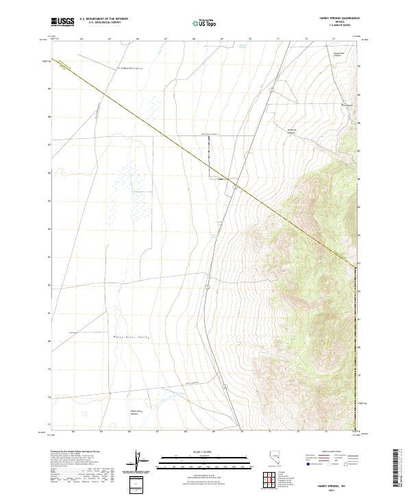
2021 Map of Hardy Springs
USGS Topo · Published 2021About this map
White River Valley defines the western expanse of this high-desert landscape, where seasonal water sources dictate the patterns of human and animal movement. The namesake Hardy Springs and other vital points like Blind Spring, Dee Gee Spring, and the curiously named Ruppes Boghole provided the necessary hydration for early travel and ranching across the eastern edge of the White River.
Find a feature on this map
20 named features on this map. Tap any name to fly to it.
Don’t see what you’re looking for? This feature index may not catch every label — zoom into the map to look around manually.
Map Details
Editions of this 2021 Hardy Springs Map
This is the sole edition of this map. No revisions or reprints were ever made.
Other maps of this area

1956 · Lund
USGS Topo · 1:250,000

1960 · Lund
USGS Topo · 1:250,000

1969 · Shingle Pass
USGS Topo · 1:24,000

1969 · Moorman Spring SE
USGS Topo · 1:24,000

1969 · Moorman Spring NW
USGS Topo · 1:24,000

1969 · Moorman Spring
USGS Topo · 1:24,000

1969 · Moorman Spring NE
USGS Topo · 1:24,000

1969 · Haggerty Spring
USGS Topo · 1:24,000
1977 · Brown Knoll
USGS Topo · 1:24,000
1978 · Lund
USGS Topo · 1:24,000