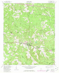
1948 Map of Harlem
USGS Topo · Published 1980About this map
Harlem serves as the central hub for this portion of eastern Georgia, situated along the Georgia railroad line that anchors the local economy and transit. The landscape transitions from the developed corridors of Sawdust and Campania to the south, where the expansive Fort Gordon Military Reservation occupies the lower right quadrant. The presence of numerous rural institutions, such as Philadelphia Church and the Central School, reflects the area's agricultural past and community distribution during the mid-20th century.
Find a feature on this map
45 named features on this map. Tap any name to fly to it.
Don’t see what you’re looking for? This feature index may not catch every label — zoom into the map to look around manually.
Map Details
Editions of this 1948 Harlem Map
2 editions found

Other maps of this area

1892 · Mc Cormick
USGS Topo · 1:125,000

1912 · Mc Cormick
USGS Topo · 1:125,000

1920 · Clarks Hill
USGS Topo · 1:48,000

1921 · Clarks Hill
USGS Topo · 1:62,500

1921 · Appling
USGS Topo · 1:62,500

1922 · Harlem
USGS Topo · 1:62,500

1922 · Hephzibah
USGS Topo · 1:62,500

1941 · Clarks Hill
USGS Topo · 1:62,500

1942 · Clarks Hill
USGS Topo · 1:62,500

1943 · Appling
USGS Topo · 1:62,500