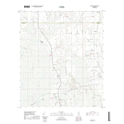
2018 Map of Harleston
USGS Topo · Published 2018About this map
Black Creek Swamp and its complex network of seasonal waterways dominate the southern portion of this Mississippi landscape. The Pascagoula River's influence is seen in features like Camp Ground Slough, Black Creek Slough, and John Goff Slough, which create a labyrinth of drainage around Parkers Island. Local settlements are scattered along the higher ground, including Harleston, Hurley, and Wade. Genealogists will find particular value in the documentation of family-connected sites such as Steede Cem and Carter Cem, as well as the historic location of Old Americus. The transition from the dense wetlands of Black Creek to the developing rural road networks near Oak Grove reflects the region's historical reliance on timber and water-based transport, now giving way to modern thoroughfares like Salem Campground Rd.
Find a feature on this map
99 named features on this map. Tap any name to fly to it.
Don’t see what you’re looking for? This feature index may not catch every label — zoom into the map to look around manually.
Map Details
Editions of this 2018 Harleston Map
This is the sole edition of this map. No revisions or reprints were ever made.
Other maps of this area

1941 · Hurley
USGS Topo · 1:62,500

1941 · Vancleave
USGS Topo · 1:62,500

1941 · Lucedale
USGS Topo · 1:62,500

1942 · Wilmer
USGS Topo · 1:62,500

1943 · Lucedale
USGS Topo · 1:62,500

1943 · Hurley
USGS Topo · 1:62,500

1943 · Vancleave
USGS Topo · 1:62,500

1944 · Wilmer
USGS Topo · 1:62,500

1944 · Vancleave
USGS Topo · 1:62,500

1953 · Mobile
USGS Topo · 1:250,000