
Loading...
Loading map...2022 Map of Harlingen
USGS Topo · Published 2022About this map
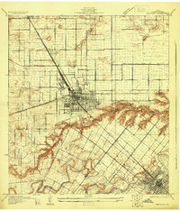
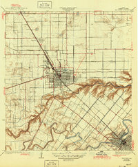
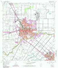
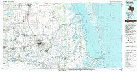
Harlingen serves as the commercial and residential hub for this portion of Cameron County, defined by a dense network of drainage and irrigation infrastructure essential to the Rio Grande Valley. The landscape is carved by the winding Arroyo Colorado and a systematic grid of canals, including Number One Canal and Number Seven Canal. These waterways dictate the layout of surrounding settlements such as Primera, Palm Valley, and Combes.
Find a feature on this map
201 named features on this map. Tap any name to fly to it.
Don’t see what you’re looking for? This feature index may not catch every label — zoom into the map to look around manually.
Map Details
Date Portrayed2022
Date Published2022
PublisherU.S. Geological Survey
Map TypeTopographic
Scale1:24000
Physical Dimensions24 x 29 inches
Editions of this 2022 Harlingen Map
This is the sole edition of this map. No revisions or reprints were ever made.
Historical Maps of Rangerville Through Time
5 maps found
Featured Locations
Source Details
SourceU.S. Geological Survey
CopyrightPublic Domain