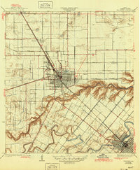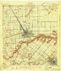
1929 Map of Harlingen
USGS Topo · Published 1929About this map
The Arroyo Colorado carves a deep, winding path through the citrus and vegetable-growing lands of the Rio Grande Valley in the late 1920s. Harlingen is shown here as a burgeoning transport hub at the junction of the St Louis Brownsville and Mexico Railway and the Southern Pacific Railroad. The town’s expansion is evident in the dense street grid surrounding Lake Harlingen and the specialized Valley Midwinter Fair Grounds. To the south, San Benito sits near the banks of Resaca de la Fresnos, highlighting the area’s dependence on natural and engineered waterways for irrigation and community layout.
Find a feature on this map
32 named features on this map. Tap any name to fly to it.
Don’t see what you’re looking for? This feature index may not catch every label — zoom into the map to look around manually.
Map Details
Editions of this 1929 Harlingen Map
This is the sole edition of this map. No revisions or reprints were ever made.
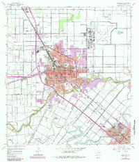
Historical Maps of Harlingen Through Time
9 maps found