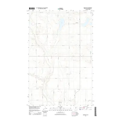
2014 Map of Harlow SE
USGS Topo · Published 2014About this map
Fish Lake and the drainage of the Big Coulee dominate this Benson County landscape, illustrating the glacial prairie pothole region of North Dakota. In 2014, the area remains primarily defined by a geometric grid of section-line roads, including 49th St NE and 52nd Ave NE, which segment the rolling terrain into vast agricultural plots. This settlement pattern reflects the enduring legacy of the Homestead Act, where land was systematically partitioned for farming. A small pocket of specialized infrastructure is found at Sorkie Airport in the south, while the intersection of ND-19 and ND-30 serves as the primary corridor for regional transit through these rural plains.
Find a feature on this map
20 named features on this map. Tap any name to fly to it.
Don’t see what you’re looking for? This feature index may not catch every label — zoom into the map to look around manually.
Map Details
Editions of this 2014 Harlow SE Map
This is the sole edition of this map. No revisions or reprints were ever made.
Other maps of this area

1932 · Flora
USGS Topo · 1:62,500

1943 · Maddock
USGS Topo · 1:62,500

1945 · Maddock
USGS Topo · 1:62,500

1951 · Flora
USGS Topo · 1:24,000

1951 · Maddock
USGS Topo · 1:24,000

1951 · Hesper
USGS Topo · 1:24,000

1951 · Flora
USGS Topo · 1:62,500

1952 · New Rockford
USGS Topo · 1:250,000

1953 · Devils Lake
USGS Topo · 1:250,000

1956 · New Rockford
USGS Topo · 1:250,000