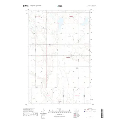
2020 Map of Harlow SE
USGS Topo · Published 2020About this map
Glacial depressions and prairie potholes define this Benson County landscape, where water bodies like Fish Lake and the Big Coulee drainage system dominate the northern terrain. The area is organized by a strict grid of gravel roads, including Toso Rd and 47th St NE, which reflect the endurance of the Public Land Survey System in rural North Dakota. For genealogists, the map preserves the exact locations of two significant local landmarks: Vasa Lutheran Cem in the northwest and Immanuel Lutheran Church Cem further south. These sites, along with the small Sortle Airport near the southern boundary, represent the primary focal points of human activity in an otherwise quiet agricultural region of the northern plains.
Find a feature on this map
24 named features on this map. Tap any name to fly to it.
Don’t see what you’re looking for? This feature index may not catch every label — zoom into the map to look around manually.
Map Details
Editions of this 2020 Harlow SE Map
This is the sole edition of this map. No revisions or reprints were ever made.
Other maps of this area

1932 · Flora
USGS Topo · 1:62,500

1943 · Maddock
USGS Topo · 1:62,500

1945 · Maddock
USGS Topo · 1:62,500

1951 · Flora
USGS Topo · 1:24,000

1951 · Maddock
USGS Topo · 1:24,000

1951 · Hesper
USGS Topo · 1:24,000

1951 · Flora
USGS Topo · 1:62,500

1952 · New Rockford
USGS Topo · 1:250,000

1953 · Devils Lake
USGS Topo · 1:250,000

1956 · New Rockford
USGS Topo · 1:250,000