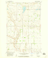
1958 Map of Harlow SE
USGS Topo · Published 1960About this map
Butte Valley and the surrounding townships of Benson County are documented here during a period of mid-century agricultural development for the Missouri River Basin. The landscape is defined by the winding course of the Big Coulee, which carves through a terrain marked by named regions such as Isabel, Albert, and Hesper. This survey provides a precise record of the rural social infrastructure of the time, noting the placement of community landmarks like School No 1, Emanuel Ch, and Vase Ch. Small-scale resource extraction is visible through scattered Gravel Pits, while Fish Lake remains a prominent water feature in the northern portion of the quadrangle. The map reflects a meticulously surveyed grid of township and range lines, including T. 154 N. and R. 70 W., anchoring the local farmsteads to the larger regional geography.
Find a feature on this map
16 named features on this map. Tap any name to fly to it.
Don’t see what you’re looking for? This feature index may not catch every label — zoom into the map to look around manually.
Map Details
Editions of this 1958 Harlow SE Map
This is the sole edition of this map. No revisions or reprints were ever made.
Other maps of this area

1932 · Flora
USGS Topo · 1:62,500

1943 · Maddock
USGS Topo · 1:62,500

1945 · Maddock
USGS Topo · 1:62,500

1951 · Flora
USGS Topo · 1:24,000

1951 · Maddock
USGS Topo · 1:24,000

1951 · Hesper
USGS Topo · 1:24,000

1951 · Flora
USGS Topo · 1:62,500

1952 · New Rockford
USGS Topo · 1:250,000

1953 · Devils Lake
USGS Topo · 1:250,000

1956 · New Rockford
USGS Topo · 1:250,000