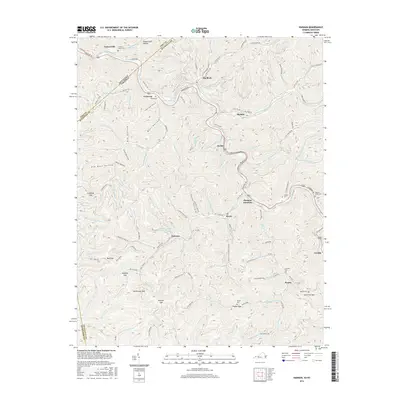
2016 Map of Harman
USGS Topo · Published 2016About this map
The winding Levisa Fork carves through the landscape along the Kentucky-Virginia border, defining a topography of narrow valleys and named gaps. Settlement patterns follow the river and its numerous tributaries, with communities like Big Rock, Weller, and Harman established along the valley floor. The industrial influence of the region is evident at the Harman Mining Corporation Pond near Maxie, reflecting the importance of coal and resource extraction to this Appalachian corridor. Multiple family and community cemeteries, including Hackney Creek Cem, Ramey Cem, and Ratliff Cem, are preserved on the hillsides, providing essential locations for genealogical research. The complex network of hollows such as Pigeonroost Hollow and Bear Hollow contrasts with the road infrastructure of Riverside Dr and various state routes that connect these historically significant mountain settlements.
Find a feature on this map
101 named features on this map. Tap any name to fly to it.
Don’t see what you’re looking for? This feature index may not catch every label — zoom into the map to look around manually.
Map Details
Editions of this 2016 Harman Map
This is the sole edition of this map. No revisions or reprints were ever made.
Other maps of this area

1886 · Grundy
USGS Topo · 1:125,000

1890 · Grundy
USGS Topo · 1:125,000

1892 · Grundy
USGS Topo · 1:125,000

1913 · Clintwood
USGS Topo · 1:62,500

1914 · Bucu
USGS Topo · 1:48,000

1914 · Hurley
USGS Topo · 1:48,000

1915 · Clintwood
USGS Topo · 1:62,500

1915 · Regina
USGS Topo · 1:48,000

1915 · Hurley
USGS Topo · 1:48,000

1916 · Bucu
USGS Topo · 1:62,500