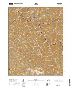
2019 Map of Harman
USGS Topo · Published 2019About this map
The Levisa Fork carves a deep path through Buchanan County, defining the settlement patterns and transportation corridors of this Appalachian landscape. Near the Kentucky border, small communities like Toonerville, Conaway, and Weller cling to the riverbank, following the winding course of Riverside Dr and the rail lines. The terrain is marked by a complex network of hollows and gaps, including Sugarcamp Hollow and Conaway Gap, which historically dictated the flow of local travel between the ridges.
Find a feature on this map
123 named features on this map. Tap any name to fly to it.
Don’t see what you’re looking for? This feature index may not catch every label — zoom into the map to look around manually.
Map Details
Editions of this 2019 Harman Map
This is the sole edition of this map. No revisions or reprints were ever made.
Other maps of this area

1886 · Grundy
USGS Topo · 1:125,000

1890 · Grundy
USGS Topo · 1:125,000

1892 · Grundy
USGS Topo · 1:125,000

1913 · Clintwood
USGS Topo · 1:62,500

1914 · Bucu
USGS Topo · 1:48,000

1914 · Hurley
USGS Topo · 1:48,000

1915 · Clintwood
USGS Topo · 1:62,500

1915 · Regina
USGS Topo · 1:48,000

1915 · Hurley
USGS Topo · 1:48,000

1916 · Bucu
USGS Topo · 1:62,500