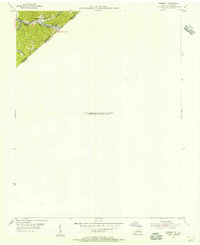
1954 Map of Harman
USGS Topo · Published 1955About this map
Levisa Fork cuts through the mountains along the state border where the Norfolk and Western railway corridor follows the river's winding path. This 1954 survey focuses on a narrow but vital transportation and settlement corridor at the junction of Pike and Buchanan counties. The small settlement of Toghertville sits nestled near the water, with local heritage preserved at the Hackney Creek Cem overlooking the drainage of Hackney Creek. The map illustrates the industrial and geographic connection between Southwest Virginia and Eastern Kentucky, defined by steep terrain like Shelley and the intricate network of tributaries including Little Hackney Creek.
Find a feature on this map
10 named features on this map. Tap any name to fly to it.
Don’t see what you’re looking for? This feature index may not catch every label — zoom into the map to look around manually.
Map Details
Editions of this 1954 Harman Map
This is the sole edition of this map. No revisions or reprints were ever made.
Other maps of this area

1886 · Grundy
USGS Topo · 1:125,000

1890 · Grundy
USGS Topo · 1:125,000

1892 · Grundy
USGS Topo · 1:125,000

1913 · Clintwood
USGS Topo · 1:62,500

1914 · Bucu
USGS Topo · 1:48,000

1914 · Hurley
USGS Topo · 1:48,000

1915 · Clintwood
USGS Topo · 1:62,500

1915 · Regina
USGS Topo · 1:48,000

1915 · Hurley
USGS Topo · 1:48,000

1916 · Bucu
USGS Topo · 1:62,500