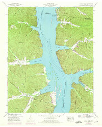
1949 Map of Harmon Creek
USGS Topo · Published 1974About this map
Kentucky Lake dominates the landscape in this 1940s survey, reflecting the transformation of the Tennessee River valley following the creation of the reservoir. The map documents the intricate network of hollows and ridges that define the shoreline, such as Highstand Ridge and Phifer Hollow. This era represents a significant shift for the region, where older river landings like Little Crooked Creek Landing began to interface with newer recreational developments like the White Oak Creek Cabin Site Area and the Harmon Creek Boat Dock.
Find a feature on this map
73 named features on this map. Tap any name to fly to it.
Don’t see what you’re looking for? This feature index may not catch every label — zoom into the map to look around manually.
Map Details
Editions of this 1949 Harmon Creek Map
3 editions found
Other maps of this area

1936 · Poplar Creek
USGS Topo · 1:24,000

1936 · McKinnon
USGS Topo · 1:24,000

1936 · Camden
USGS Topo · 1:24,000

1936 · Big Sandy
USGS Topo · 1:24,000

1936 · Stewart
USGS Topo · 1:24,000

1936 · Halls Creek
USGS Topo · 1:24,000

1936 · Johnsonville
USGS Topo · 1:24,000

1936 · Harmon Creek
USGS Topo · 1:24,000

1936 · Waverly
USGS Topo · 1:24,000

1949 · Harmon Creek
USGS Topo · 1:24,000