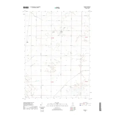
2018 Map of Harmon
USGS Topo · Published 2018About this map
Harmon serves as the central hub for this Lee County agricultural landscape, where the grain-farming economy is defined by an extensive network of drainage infrastructure. The presence of the Winnebago Ditch, Main Ditch, and Green River illustrates the historical effort to manage the prairie's water table for cultivation. To the west, the small settlement of Van Petten sits along the intersection of Van Petten Rd and Schilpp Rd. For those tracing local family histories, the Holy Cross Catholic Cem and Centenary Cem provide important genealogical anchors near the village center. The terrain is crisscrossed by a rigid grid of country lanes like Sterling Rd and Henry Rd, which separate the vast sections of t20n r8e and t19n r8e, reflecting the enduring influence of the Public Land Survey System on the Illinois countryside.
Find a feature on this map
44 named features on this map. Tap any name to fly to it.
Don’t see what you’re looking for? This feature index may not catch every label — zoom into the map to look around manually.
Map Details
Editions of this 2018 Harmon Map
This is the sole edition of this map. No revisions or reprints were ever made.
Other maps of this area

1918 · Dixon
USGS Topo · 1:62,500

1930 · Woodsung
USGS Topo · 1:48,000

1946 · Sterling
USGS Topo · 1:62,500

1948 · Sterling
USGS Topo · 1:62,500

1949 · Walnut
USGS Topo · 1:62,500

1950 · Dixon
USGS Topo · 1:62,500

1951 · Amboy
USGS Topo · 1:62,500

1958 · Aurora
USGS Topo · 1:250,000

1961 · Aurora
USGS Topo · 1:250,000

1982 · Harmon
USGS Topo · 1:24,000