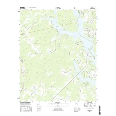
2017 Map of Harmony
USGS Topo · Published 2017About this map
Oconee National Forest defines the southwestern landscape of this Putnam County region, where the terrain is carved by a dense network of waterways like Weaver Br and Hightog Br. The settlement of Harmony serves as a central point for the surrounding rural roads, while the northeastern portion of the sheet is dominated by the sprawling reaches of Lake Oconee. This area shows a transition from the protected forest lands and agricultural fields around Rudden to the more developed waterfront residential areas and docks lining the lake's fingers. Smaller named water bodies such as Reeses Lake and Kraft Lake dot the eastern side near the Greene County line. The mapping of Jefferson and numerous family-named roads like Reids Ferry Rd and Parks Mill Dr provides specific locations for researchers tracing the modern layout of these established Georgia communities.
Find a feature on this map
131 named features on this map. Tap any name to fly to it.
Don’t see what you’re looking for? This feature index may not catch every label — zoom into the map to look around manually.
Map Details
Editions of this 2017 Harmony Map
This is the sole edition of this map. No revisions or reprints were ever made.
Other maps of this area

1953 · Athens
USGS Topo · 1:250,000

1958 · Athens
USGS Topo · 1:250,000

1959 · Athens
USGS Topo · 1:250,000

1963 · Athens
USGS Topo · 1:250,000

1972 · Liberty
USGS Topo · 1:24,000

1972 · Meda
USGS Topo · 1:24,000

1972 · Eatonton
USGS Topo · 1:24,000

1972 · Buckhead
USGS Topo · 1:24,000

1972 · Harmony
USGS Topo · 1:24,000

1972 · Rock Eagle Lake
USGS Topo · 1:24,000