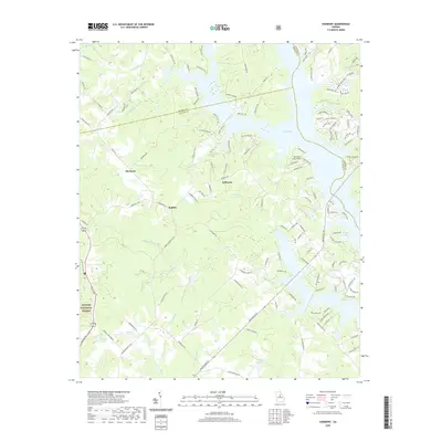
2020 Map of Harmony
USGS Topo · Published 2020About this map
Lake Oconee dominates the eastern landscape of this modern survey where Putnam, Morgan, and Greene counties converge. The terrain is characterized by a dense network of residential corridors and recreational access points branching toward the shoreline, including Sebastian Cove Airport and various private landings. In the interior, the small settlements of Harmony, Jefferson, and Rudden are surrounded by a complex system of drainage creeks like Clarks Fork, Highlog Br, and Tanyard Br. The southwestern portion of the sheet is anchored by the Oconee National Forest, providing a stark contrast between protected woodlands and the residential development focused around water bodies like Walker Lake and Dodson Pond. This map details the contemporary evolution of the Georgia Piedmont, showing how older rural communities have integrated with late-twentieth-century lakeside infrastructure.
Find a feature on this map
133 named features on this map. Tap any name to fly to it.
Don’t see what you’re looking for? This feature index may not catch every label — zoom into the map to look around manually.
Map Details
Editions of this 2020 Harmony Map
This is the sole edition of this map. No revisions or reprints were ever made.
Other maps of this area

1953 · Athens
USGS Topo · 1:250,000

1958 · Athens
USGS Topo · 1:250,000

1959 · Athens
USGS Topo · 1:250,000

1963 · Athens
USGS Topo · 1:250,000

1972 · Liberty
USGS Topo · 1:24,000

1972 · Meda
USGS Topo · 1:24,000

1972 · Eatonton
USGS Topo · 1:24,000

1972 · Buckhead
USGS Topo · 1:24,000

1972 · Harmony
USGS Topo · 1:24,000

1972 · Rock Eagle Lake
USGS Topo · 1:24,000