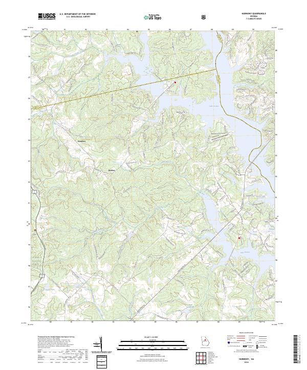
2024 Map of Harmony
USGS Topo · Published 2024About this map
Harmony and Rudden anchor this central Georgia landscape, where the rolling hills of Putnam County meet the sprawling eastern shoreline of Lake Oconee. The map reveals a complex interface between modern residential development and managed timberlands, particularly where the Oconee National Forest borders the lake’s western reaches. Numerous drainage systems, including Lick Creek and the Jacks Fork of Little Sugar Creek, carve through the terrain, feeding into the reservoir and creating the intricate, finger-like coves that define the local geography. Significant infrastructure such as Sebastian Cove Airport and an extensive network of secondary roads like Parks Mill Rd and Harmony Rd highlight the transition of this area into a recreational and residential hub. Notable water bodies such as Reeses Lake and Kraft Lake dot the eastern side of the main reservoir, providing further evidence of the water-centric land use that dominates this portion of the Piedmont.
Find a feature on this map
136 named features on this map. Tap any name to fly to it.
Don’t see what you’re looking for? This feature index may not catch every label — zoom into the map to look around manually.
Map Details
Editions of this 2024 Harmony Map
This is the sole edition of this map. No revisions or reprints were ever made.
Other maps of this area

1953 · Athens
USGS Topo · 1:250,000

1958 · Athens
USGS Topo · 1:250,000

1959 · Athens
USGS Topo · 1:250,000

1963 · Athens
USGS Topo · 1:250,000

1972 · Liberty
USGS Topo · 1:24,000

1972 · Meda
USGS Topo · 1:24,000

1972 · Eatonton
USGS Topo · 1:24,000

1972 · Buckhead
USGS Topo · 1:24,000

1972 · Harmony
USGS Topo · 1:24,000

1972 · Rock Eagle Lake
USGS Topo · 1:24,000