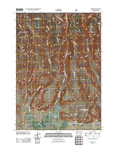
2011 Map of Harney
USGS Topo · Published 2011About this map
Harney and its surrounding high-desert landscape are defined by a complex network of seasonal drainage and canyon systems in this 2011 survey. The settlement is situated near the Harney Cemetery at the intersection of several local routes, including Old Fort Harney Rd and Reed Rd. The terrain is deeply inscribed by watercourses such as Mill Creek, Coffeepot Creek, and Rattlesnake Creek, which descend from the northern highlands toward the valley floor. To the east, the landscape becomes increasingly irregular with the presence of Mortimer Canyon, Davis Gulch, and the Mortimer Canyon Reservoir. This map documents a sparsely populated region where infrastructure is concentrated along the historic road network, serving isolated outposts like Harris Pl. The mapping detail captures the essential water sources for this arid environment, ranging from Shellrock Spring to the various forks of Cow Creek.
Find a feature on this map
21 named features on this map. Tap any name to fly to it.
Don’t see what you’re looking for? This feature index may not catch every label — zoom into the map to look around manually.
Map Details
Editions of this 2011 Harney Map
This is the sole edition of this map. No revisions or reprints were ever made.
Other maps of this area

1955 · Burns
USGS Topo · 1:250,000

1958 · Burns
USGS Topo · 1:250,000

1959 · Burns
USGS Topo · 1:250,000

1959 · Harney
USGS Topo · 1:62,500

1961 · Calamity Butte
USGS Topo · 1:62,500

1968 · Van
USGS Topo · 1:62,500

1973 · Buchanan
USGS Topo · 1:24,000

1973 · Carson Point
USGS Topo · 1:24,000

1978 · Stinkingwater Mountains
USGS Topo · 1:100,000
1990 · Ninemile Slough
USGS Topo · 1:24,000