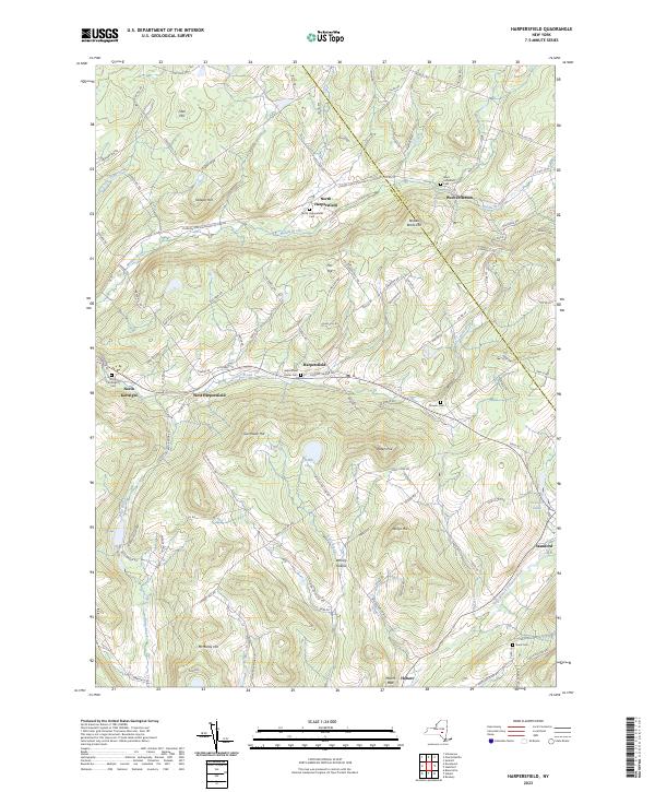
2023 Map of Harpersfield
USGS Topo · Published 2023About this map
The West Branch Delaware River flows through the southeastern corner of this landscape, anchoring the valley towns of Stamford and Hobart. This region of Delaware County is defined by a dense network of upland ridges and creek valleys, where small settlements like Harpersfield and West Harpersfield were established along the Center Brook. The distribution of local landmarks such as Harpersfield Center Cem and Stevens Cem reflects a decentralized pattern of early rural life, with family and community burying grounds scattered among the hills.
Find a feature on this map
115 named features on this map. Tap any name to fly to it.
Don’t see what you’re looking for? This feature index may not catch every label — zoom into the map to look around manually.
Map Details
Editions of this 2023 Harpersfield Map
This is the sole edition of this map. No revisions or reprints were ever made.
Other maps of this area

1904 · Richmondville
USGS Topo · 1:62,500

1904 · Hobart
USGS Topo · 1:62,500

1907 · Cooperstown
USGS Topo · 1:62,500

1909 · Cooperstown
USGS Topo · 1:62,500

1909 · Delhi
USGS Topo · 1:62,500

1911 · Delhi
USGS Topo · 1:62,500

1943 · Bloomville
USGS Topo · 1:24,000

1943 · Charlotteville
USGS Topo · 1:24,000
1943 · Schenevus
USGS Topo · 1:24,000

1943 · Summit
USGS Topo · 1:24,000