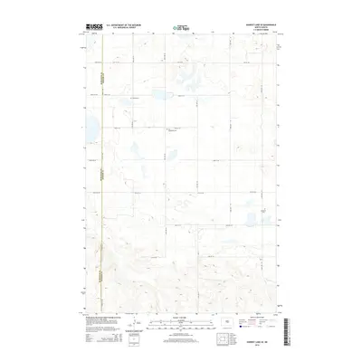
2014 Map of Harriet Lake SE
USGS Topo · Published 2014About this map
The rolling plains along the boundary of Burleigh Co and Kidder Co define this landscape, where the rural character of central North Dakota is preserved in its section lines and cemeteries. This 2014 survey documents a sparsely populated agricultural region, notable for the clustering of local burial sites that speak to the area’s homesteading heritage. United Cem sits centrally, while further south, the proximity of Zion Langedahl Cem and Langedahl Cem suggests the historical importance of these specific locales to the surrounding farmsteads. The terrain is navigated by an orderly grid of local connectors, including 418th St NE and 27th St SE, which facilitate the movement of equipment and livestock through the prairie. The map provides a clear look at the drainage patterns and small depressions typical of the region's geography, offering researchers a detailed view of property divisions at the start of the twenty-first century.
Find a feature on this map
21 named features on this map. Tap any name to fly to it.
Don’t see what you’re looking for? This feature index may not catch every label — zoom into the map to look around manually.
Map Details
Editions of this 2014 Harriet Lake SE Map
This is the sole edition of this map. No revisions or reprints were ever made.
Other maps of this area

1951 · Driscoll
USGS Topo · 1:62,500

1952 · Steele NW
USGS Topo · 1:24,000

1952 · New Rockford
USGS Topo · 1:250,000

1953 · Jamestown
USGS Topo · 1:250,000

1954 · Bismarck
USGS Topo · 1:250,000

1954 · McClusky
USGS Topo · 1:250,000

1956 · New Rockford
USGS Topo · 1:250,000

1956 · Jamestown
USGS Topo · 1:250,000

1958 · Bismarck
USGS Topo · 1:250,000

1958 · McClusky
USGS Topo · 1:250,000