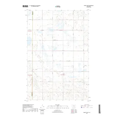
2018 Map of Harriet Lake SE
USGS Topo · Published 2018About this map
The border of Burleigh and Kidder counties defines this prairie landscape, where a grid of rural section roads such as 279th Ave NE and 418th St NE organizes the agricultural terrain. The map is particularly notable for its record of early community centers and rural congregations, marking several burial grounds that served the surrounding farmsteads. These include Evangelical Immanuel Cem and the Zion Langedahl Lutheran Cem located along 23rd St SE. Further east and south, the Langedahl Cem and Chestina Cem stand as quiet markers of the families who settled this portion of the North Dakota plains. The Numerous wetlands and small potholes across the quadrangle reflect the characteristic glacial topography of the region, interspersed between local routes like 266Ave NE and 25th St SE.
Find a feature on this map
29 named features on this map. Tap any name to fly to it.
Don’t see what you’re looking for? This feature index may not catch every label — zoom into the map to look around manually.
Map Details
Editions of this 2018 Harriet Lake SE Map
This is the sole edition of this map. No revisions or reprints were ever made.
Other maps of this area

1951 · Driscoll
USGS Topo · 1:62,500

1952 · Steele NW
USGS Topo · 1:24,000

1952 · New Rockford
USGS Topo · 1:250,000

1953 · Jamestown
USGS Topo · 1:250,000

1954 · Bismarck
USGS Topo · 1:250,000

1954 · McClusky
USGS Topo · 1:250,000

1956 · New Rockford
USGS Topo · 1:250,000

1956 · Jamestown
USGS Topo · 1:250,000

1958 · Bismarck
USGS Topo · 1:250,000

1958 · McClusky
USGS Topo · 1:250,000