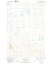
1979 Map of Harriet Lake SE
USGS Topo · Published 1979About this map
The prairie landscape of Tuttle and Chestina townships in the late 1970s is defined by its small-scale rural infrastructure and protected wetlands. This portion of Kidder County shows a sparsely populated agricultural region where community life centered on several local cemeteries, including United Cem, Zion Langedahl Cem, and Langedahl Cem. The presence of a localized Townhall serves as a reminder of the township-level governance that organized these North Dakota plains. Significant portions of the terrain are dedicated to conservation, with the Arena State Game Management Area and a National Waterfowl Production Area indicating the importance of the regional pothole habitat. Scattered Gravel Pit sites and a single Well reflect the modest industrial activities supporting the local road network and farmsteads near the Burleigh and Kidder county line.
Find a feature on this map
13 named features on this map. Tap any name to fly to it.
Don’t see what you’re looking for? This feature index may not catch every label — zoom into the map to look around manually.
Map Details
Editions of this 1979 Harriet Lake SE Map
This is the sole edition of this map. No revisions or reprints were ever made.
Other maps of this area

1951 · Driscoll
USGS Topo · 1:62,500

1952 · Steele NW
USGS Topo · 1:24,000

1952 · New Rockford
USGS Topo · 1:250,000

1953 · Jamestown
USGS Topo · 1:250,000

1954 · Bismarck
USGS Topo · 1:250,000

1954 · McClusky
USGS Topo · 1:250,000

1956 · New Rockford
USGS Topo · 1:250,000

1956 · Jamestown
USGS Topo · 1:250,000

1958 · Bismarck
USGS Topo · 1:250,000

1958 · McClusky
USGS Topo · 1:250,000