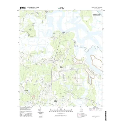
2017 Map of Harrietts Bluff
USGS Topo · Published 2017About this map
Navsubase Kings Bay and the Kings Bay Base dominate the central landscape of this 2017 coastal Georgia survey, illustrating the significant military footprint along the North River and its marshes. To the south, the city of Saint Marys is clearly defined, situated near the St Marys Airport and the tidal reaches of Dark Entry Creek. The map provides a detailed look at the interface between established settlements and the intricate aquatic geography of the Intracoastal Waterway.
Find a feature on this map
162 named features on this map. Tap any name to fly to it.
Don’t see what you’re looking for? This feature index may not catch every label — zoom into the map to look around manually.
Map Details
Editions of this 2017 Harrietts Bluff Map
This is the sole edition of this map. No revisions or reprints were ever made.
Other maps of this area

1918 · St Marys
USGS Topo · 1:62,500

1918 · Cumberland Island
USGS Topo · 1:62,500

1918 · Kingsland
USGS Topo · 1:62,500

1919 · Fernandina
USGS Topo · 1:62,500

1919 · St Marys
USGS Topo · 1:62,500

1930 · Cumberland Island
USGS Topo · 1:62,500

1944 · Fernandina
USGS Topo · 1:62,500

1945 · Cumberland Island
USGS Topo · 1:62,500

1948 · Jacksonville
USGS Topo · 1:250,000

1957 · Jacksonville
USGS Topo · 1:250,000