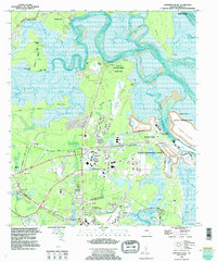
1994 Map of Harrietts Bluff
USGS Topo · Published 1995About this map
St Marys and the sprawling Kings Bay Naval Submarine Base define the coastal landscape of this 1994 Camden County survey. The map details the heavy military footprint of the era, where roads named for the USS Benjamin Franklin and USS Henry L Stimson serve the submarine facility. Just west of the base, the John H Mcintosh Sugar Mill Site Ruins provide a notable archaeological anchor, marking the transition from historic plantation-era industry to the modern defense economy.
Find a feature on this map
72 named features on this map. Tap any name to fly to it.
Don’t see what you’re looking for? This feature index may not catch every label — zoom into the map to look around manually.
Map Details
Editions of this 1994 Harrietts Bluff Map
This is the sole edition of this map. No revisions or reprints were ever made.
Other maps of this area

1918 · St Marys
USGS Topo · 1:62,500

1918 · Cumberland Island
USGS Topo · 1:62,500

1918 · Kingsland
USGS Topo · 1:62,500

1919 · Fernandina
USGS Topo · 1:62,500

1919 · St Marys
USGS Topo · 1:62,500

1930 · Cumberland Island
USGS Topo · 1:62,500

1944 · Fernandina
USGS Topo · 1:62,500

1945 · Cumberland Island
USGS Topo · 1:62,500

1948 · Jacksonville
USGS Topo · 1:250,000

1957 · Jacksonville
USGS Topo · 1:250,000