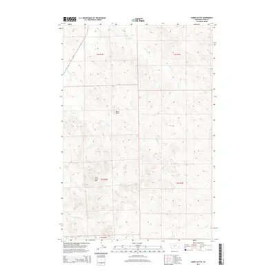
2014 Map of Harris Buttes
USGS Topo · Published 2014About this map
Harris Buttes and Wild Horse Mtn dominate this Custer County landscape, where the high plains are carved by a dense network of seasonal drainages. The drainage patterns of Pumpkin Cr and Anderson Cr reveal the intricate topography of southeastern Montana's ranching country. This 2014 survey documents a territory largely defined by its natural hydrology, with Harris Cr, Road Cr, and Broughton Cr branching across the township and range grid. The presence of MT-59 in the northwest corner provides the primary modern transport link through this cattle-raising region, illustrating how contemporary infrastructure skirts the most prominent terrain features like Sand Cr at the quadrangle's southern edge.
Find a feature on this map
14 named features on this map. Tap any name to fly to it.
Don’t see what you’re looking for? This feature index may not catch every label — zoom into the map to look around manually.
Map Details
Editions of this 2014 Harris Buttes Map
This is the sole edition of this map. No revisions or reprints were ever made.
Other maps of this area

1953 · Miles City
USGS Topo · 1:250,000

1954 · Ekalaka
USGS Topo · 1:250,000

1956 · Ekalaka
USGS Topo · 1:250,000

1957 · Miles City
USGS Topo · 1:250,000

1958 · Miles City
USGS Topo · 1:250,000

1958 · Ekalaka
USGS Topo · 1:250,000

1965 · Ekalaka
USGS Topo · 1:250,000

1969 · Beebe SW
USGS Topo · 1:24,000

1969 · Miles City Creek
USGS Topo · 1:24,000
1969 · Beebe
USGS Topo · 1:24,000