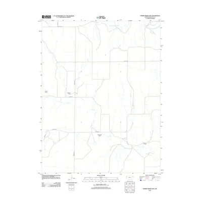
2012 Map of Harris Draw East
USGS Topo · Published 2012About this map
The N Fork Smoky Hill River carves through the northern reaches of this high plains landscape, defining the local drainage system in Wallace County. The terrain is characterized by a series of significant drainage basins and draws that feed toward the river and Lake Cr, including Harris Draw, Gardner Draw, Bradshaw Draw, and Hudkins Draw. These named features suggest a long history of ranching and land use where specific topographical depressions provided essential seasonal water or landmarks for early settlers. The modern infrastructure is reflected in a grid of section roads such as Road WA-BB and Road WA-N26, which cut across the natural hydrology, illustrating the intersection of traditional western water rights and the formal Public Land Survey System.
Find a feature on this map
13 named features on this map. Tap any name to fly to it.
Don’t see what you’re looking for? This feature index may not catch every label — zoom into the map to look around manually.
Map Details
Editions of this 2012 Harris Draw East Map
This is the sole edition of this map. No revisions or reprints were ever made.
Other maps of this area

1954 · Goodland
USGS Topo · 1:250,000

1955 · Scott City
USGS Topo · 1:250,000

1956 · Goodland
USGS Topo · 1:250,000

1957 · Goodland
USGS Topo · 1:250,000

1958 · Scott City
USGS Topo · 1:250,000

1959 · Wallace
USGS Topo · 1:62,500

1959 · Harris Draw
USGS Topo · 1:62,500

1969 · Mc Allaster NW
USGS Topo · 1:24,000

1969 · Russell Springs 2 NW
USGS Topo · 1:24,000
1969 · Mc Allaster
USGS Topo · 1:24,000