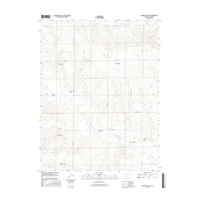
2015 Map of Harris Draw East
USGS Topo · Published 2015About this map
The N Fork Smoky Hill River carves through the northern reaches of Wallace County, defining a landscape of high plains drainage systems in Western Kansas. This area is characterized by a series of prominent, family-named ephemeral watercourses known as draws, including Harris Draw, Gardner Draw, and Depperschmidt Draw. These features, along with Hudkins Draw and Bradshaw Draw, trace the local topography as it slopes toward the river and Lake Cr. The rural road network follows a strict sectional grid, yet names like Zigzag Rd and Blue Bird Rd hint at the local character of these connectors. This survey provides a precise look at the township and range divisions, specifically covering parts of t11s r39w, t11s r38w, t12s r39w, and t12s r38w.
Find a feature on this map
24 named features on this map. Tap any name to fly to it.
Don’t see what you’re looking for? This feature index may not catch every label — zoom into the map to look around manually.
Map Details
Editions of this 2015 Harris Draw East Map
This is the sole edition of this map. No revisions or reprints were ever made.
Other maps of this area

1954 · Goodland
USGS Topo · 1:250,000

1955 · Scott City
USGS Topo · 1:250,000

1956 · Goodland
USGS Topo · 1:250,000

1957 · Goodland
USGS Topo · 1:250,000

1958 · Scott City
USGS Topo · 1:250,000

1959 · Wallace
USGS Topo · 1:62,500

1959 · Harris Draw
USGS Topo · 1:62,500

1969 · Mc Allaster NW
USGS Topo · 1:24,000

1969 · Russell Springs 2 NW
USGS Topo · 1:24,000
1969 · Mc Allaster
USGS Topo · 1:24,000