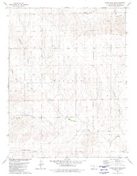
1979 Map of Harris Draw East
USGS Topo · Published 1980About this map
Smoky Hill R and the Fk Smoky Hill R define the northern drainage of this High Plains landscape in western Kansas. The terrain is characterized by a series of significant erosional features including Gardner Draw, Harris Draw, and Bradshaw Draw, which channel seasonal runoff toward Lake Creek. This topography reflects the hydrological patterns of Wallace County during the late 1970s, where land use was primarily focused on resource extraction and cattle ranching. Evidence of local industry appears in the form of multiple Marl Pits and a solitary Marl Pit in the northeast, alongside various scattered wells that indicate the vital importance of groundwater in this arid environment. The map provides a precise record of the land surface before contemporary agricultural or industrial shifts altered the traditional drainage ways like Hudkins Draw and Depperschmidt Draw.
Find a feature on this map
12 named features on this map. Tap any name to fly to it.
Don’t see what you’re looking for? This feature index may not catch every label — zoom into the map to look around manually.
Map Details
Editions of this 1979 Harris Draw East Map
This is the sole edition of this map. No revisions or reprints were ever made.
Other maps of this area

1954 · Goodland
USGS Topo · 1:250,000

1955 · Scott City
USGS Topo · 1:250,000

1956 · Goodland
USGS Topo · 1:250,000

1957 · Goodland
USGS Topo · 1:250,000

1958 · Scott City
USGS Topo · 1:250,000

1959 · Wallace
USGS Topo · 1:62,500

1959 · Harris Draw
USGS Topo · 1:62,500

1969 · Mc Allaster NW
USGS Topo · 1:24,000

1969 · Russell Springs 2 NW
USGS Topo · 1:24,000
1969 · Mc Allaster
USGS Topo · 1:24,000