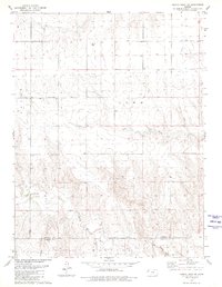
1979 Map of Harris Draw NE
USGS Topo · Published 1980About this map
The North Fork Smoky Hill River meanders across the southern portion of this landscape, marking a distinct geographical transition as it crosses the border between Sherman and Wallace counties. This late-1970s survey captures the agricultural and topographical character of the High Plains, where the terrain is defined by the Smoky region's drainage patterns. Evidence of local settlement and community life is anchored by the Mennonite Cem in the northwestern sector, while the presence of a Gravel Pit and several mapped wells indicates the rural industry and water management necessary for life in this arid Kansas environment. Drainage features like Sand Creek carve through the sections, illustrating the natural watershed that feeds into the larger river system to the south.
Find a feature on this map
10 named features on this map. Tap any name to fly to it.
Don’t see what you’re looking for? This feature index may not catch every label — zoom into the map to look around manually.
Map Details
Editions of this 1979 Harris Draw NE Map
This is the sole edition of this map. No revisions or reprints were ever made.
Other maps of this area

1954 · Goodland
USGS Topo · 1:250,000

1956 · Goodland
USGS Topo · 1:250,000

1957 · Goodland
USGS Topo · 1:250,000

1959 · Harris Draw
USGS Topo · 1:62,500

1966 · Goodland
USGS Topo · 1:24,000

1966 · Edson
USGS Topo · 1:24,000

1966 · Brewster
USGS Topo · 1:24,000

1969 · Mc Allaster NW
USGS Topo · 1:24,000
1969 · Mc Allaster
USGS Topo · 1:24,000
1979 · Harris Draw East
USGS Topo · 1:24,000