
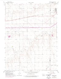
1966 Map of Brewster
USGS Topo · Published 1968About this map
Brewster straddles the county line between Sherman Co and Thomas Co in this mid-1960s landscape, serving as a hub for the surrounding agricultural townships of West Hale, Union, Kingery, and I O W A. The era is defined by significant infrastructure transitions, most notably the modern highway marked Under Construction that runs parallel to the historic Chicago Rock Island and Pacific railroad. The drainage patterns of the High Plains are clearly visible as the headwaters of South Fork Sappa Creek and the South Fork Solomon River carve through the terrain. For local historians, the map documents established community landmarks such as Fairview Cem and Brewster Cem, alongside the industrial presence of scattered Gravel Pits and numerous water wells that supported the region's development.
Find a feature on this map
15 named features on this map. Tap any name to fly to it.
Don’t see what you’re looking for? This feature index may not catch every label — zoom into the map to look around manually.
Map Details
Editions of this 1966 Brewster Map
2 editions found
Other maps of this area

1954 · Goodland
USGS Topo · 1:250,000

1956 · Goodland
USGS Topo · 1:250,000

1957 · Goodland
USGS Topo · 1:250,000

1959 · Harris Draw
USGS Topo · 1:62,500

1966 · Edson
USGS Topo · 1:24,000

1966 · Goodland NE
USGS Topo · 1:24,000

1966 · Brewster NW
USGS Topo · 1:24,000

1966 · Brewster SE
USGS Topo · 1:24,000

1967 · Brewster NE
USGS Topo · 1:24,000

1969 · Mc Allaster NW
USGS Topo · 1:24,000