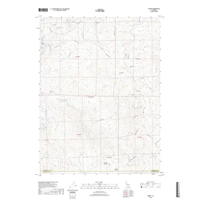
2018 Map of Harris
USGS Topo · Published 2018About this map
The rugged boundary between Humboldt and Mendocino counties is defined by dramatic elevation changes and a network of named ranch roads and openings. This landscape is anchored by high points such as Pratt Mtn, Little Buck Mtn, and Panther Peak, overlooking the deep drainages of the E Br S Fork Eel River and its numerous tributaries. Human activity in this remote region is marked by historic clearings or "openings," including Lewis Opening, Chervimov Opening, and Peterson Opening, which suggest the area's agricultural and ranching legacy. A winding system of roads like Bell Springs Rd and Jewett Rd connects isolated landmarks, while the Harris Cem serves as a quiet record of the families who settled this territory along Mail Ridge. The map detail captures the specialized geography of Northern California's back-country, where land use follows the ridges and creek beds.
Find a feature on this map
50 named features on this map. Tap any name to fly to it.
Don’t see what you’re looking for? This feature index may not catch every label — zoom into the map to look around manually.
Map Details
Editions of this 2018 Harris Map
This is the sole edition of this map. No revisions or reprints were ever made.
Other maps of this area

1920 · Cummings
USGS Topo · 1:62,500

1920 · Harris
USGS Topo · 1:62,500

1921 · Briceland
USGS Topo · 1:62,500

1949 · Alderpoint
USGS Topo · 1:62,500

1949 · Garberville
USGS Topo · 1:62,500

1950 · Piercy
USGS Topo · 1:62,500

1951 · Alderpoint
USGS Topo · 1:62,500

1951 · Garberville
USGS Topo · 1:62,500

1952 · Leggett
USGS Topo · 1:62,500

1957 · Ukiah
USGS Topo · 1:250,000