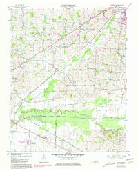
1956 Map of Harris
USGS Topo · Published 1981About this map
Morris Slave Cem and Murphy Cem sit among the headwaters of Deer Creek, providing significant genealogical touchstones for this corner of West Tennessee. The landscape is defined by its drainage towards the North Fork Obion River, which forms the boundary between Obion Co and Weakley Co. The settlement pattern centers on small rural communities like Harris and Terrell, connected by the steel of the Illinois Central Gulf and the Louisville and Nashville railroads. Local life revolves around country sanctuaries such as Chapel Hill Ch and Johnson Grove Ch. Cultural landmarks of the mid-20th century are evident in the Drive-in Theater and the County Memorial Gardens, while the Gaging Station on the river indicates the ongoing management of the area's vital water resources.
Find a feature on this map
24 named features on this map. Tap any name to fly to it.
Don’t see what you’re looking for? This feature index may not catch every label — zoom into the map to look around manually.
Map Details
Editions of this 1956 Harris Map
3 editions found

Other maps of this area

1939 · Hickman
USGS Topo · 1:62,500

1950 · Martin
USGS Topo · 1:24,000

1950 · Rives
USGS Topo · 1:24,000

1951 · Rives
USGS Topo · 1:24,000

1951 · Cayce
USGS Topo · 1:24,000

1952 · Crutchfield
USGS Topo · 1:24,000

1952 · Water Valley
USGS Topo · 1:24,000

1952 · Water Valley
USGS Topo · 1:62,500

1954 · Union City
USGS Topo · 1:24,000

1954 · Hickman
USGS Topo · 1:62,500