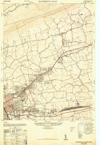
1947 Map of Harrisburg East
USGS Topo · Published 1947About this map
The B L U E M O U N T A I N ridge forms the northern boundary of this 1947 landscape, where suburban growth began to push eastward from Harrisburg. Post-war development is evident in the residential clusters of Progress, Penbrook, and Paxtonia, with new roads marked as under construction near Linglestown. This era captures a transition from rural farmland to a more structured suburban network, yet the map still preserves earlier institutional and social landmarks. Large landholdings for the State Hospital For Insane and the Dauphin County Home occupy significant acreage, while the Penn-Harris Airport and the Abandoned Race Track north of Wenriches Church reflect the changing recreational and transportation needs of the mid-century. Along the southern edge, the industrial and transit corridor follows the Reading railroad line through Paxtang and Rutherford Heights, anchored by the Mobilgas Gasoline Terminal and the Lebanon Valley Branch.
Find a feature on this map
42 named features on this map. Tap any name to fly to it.
Don’t see what you’re looking for? This feature index may not catch every label — zoom into the map to look around manually.
Map Details
Editions of this 1947 Harrisburg East Map
4 editions found
Other maps of this area

1892 · Hummelstown
USGS Topo · 1:62,500

1892 · Harrisburg
USGS Topo · 1:62,500

1899 · Harrisburg
USGS Topo · 1:62,500

1906 · New Cumberland
USGS Topo · 1:62,500

1908 · Middletown
USGS Topo · 1:62,500

1924 · Hummelstown
USGS Topo · 1:62,500

1924 · Harrisburg
USGS Topo · 1:62,500

1943 · New Cumberland
USGS Topo · 1:62,500

1943 · Middletown
USGS Topo · 1:62,500

1943 · Harrisburg
USGS Topo · 1:62,500
Featured Places
- Harrisburg, PA
- Colonial Park, Lower Paxton Township
- Progress, Susquehanna Township
- Linglestown, Lower Paxton Township
- Rutherford, Swatara Township