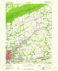
1947 Map of Harrisburg East
USGS Topo · Published 1960About this map
Blue Mountain looms over the northern edge of this 1940s landscape, providing a sharp topographical boundary for the expanding suburbs of Harrisburg. Post-war development is evident across Susquehanna and Lower Paxton, where clusters like Colonial Park and Progress bridge the gap between the city core and rural farmsteads. The infrastructure of the era is anchored by the Reading RR and Pennsylvania RR corridors, which serve the industrial and transit needs of the state capital. Local genealogy is well-represented through numerous landmark institutions, from Lincoln Cem and Prospect Hill Cem to neighborhood anchors like Harris High Sch and Trinity Ch. The map also captures specialized facilities like the Penn-Harris Airport and the State Police headquarters, illustrating a region balancing its role as a seat of government with rapid mid-century residential growth.
Find a feature on this map
55 named features on this map. Tap any name to fly to it.
Don’t see what you’re looking for? This feature index may not catch every label — zoom into the map to look around manually.
Map Details
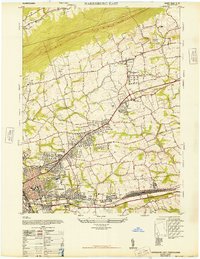
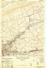
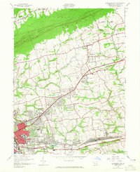
Editions of this 1947 Harrisburg East Map
4 editions found
Other maps of this area

1892 · Hummelstown
USGS Topo · 1:62,500

1892 · Harrisburg
USGS Topo · 1:62,500

1899 · Harrisburg
USGS Topo · 1:62,500

1906 · New Cumberland
USGS Topo · 1:62,500

1908 · Middletown
USGS Topo · 1:62,500

1924 · Hummelstown
USGS Topo · 1:62,500

1924 · Harrisburg
USGS Topo · 1:62,500

1943 · New Cumberland
USGS Topo · 1:62,500

1943 · Middletown
USGS Topo · 1:62,500

1943 · Harrisburg
USGS Topo · 1:62,500
Featured Places
- Harrisburg, PA
- Colonial Park, Lower Paxton Township
- Progress, Susquehanna Township
- Linglestown, Lower Paxton Township
- Rutherford, Swatara Township