2021 Map of Harrisburg
USGS Topo · Published 2021About this map
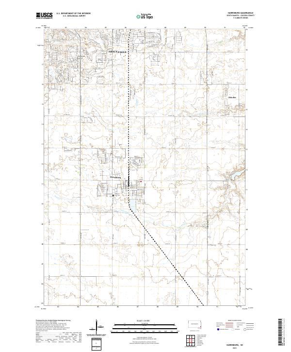
Harrisburg serves as a focal point for this section of Lincoln County, showcasing the rapid expansion of residential neighborhoods and industrial areas south of Sioux Falls. The map reveals a transitioning landscape where suburban street grids, such as those near E 69th St and E 77th St, meet the established agricultural sections of the Coteau des Prairies. Along the southern edge of the Sioux Falls urban fringe, the community of Shindler sits near the winding course of Spring Cr. Local history is anchored by Pleasant View Cem, located just south of the Harrisburg town center. The drainage patterns of Ninemile Cr cut through the lower sections of the survey, illustrating the natural topography that has influenced the layout of Co Hwy 106 and the surrounding rural road network.
Find a feature on this map
50 named features on this map. Tap any name to fly to it.
Don’t see what you’re looking for? This feature index may not catch every label — zoom into the map to look around manually.
Map Details
Editions of this 2021 Harrisburg Map
This is the sole edition of this map. No revisions or reprints were ever made.