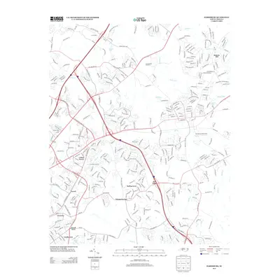
2013 Map of Harrisburg
USGS Topo · Published 2013About this map
The Rocky River and its numerous tributaries, including Mallard Cr and Back Cr, carve through this rapidly developing landscape northeast of Charlotte. By the early 21st century, the area shows a complex transition from its industrial past, represented by Roberta Mill, to a modern hub of commerce and entertainment. The massive footprint of the Charlotte Motor Speedway dominates the central terrain, while major retail developments like Concord Mills signal the shift toward a consumer-driven economy. Interspersed among the dense network of highways like I-85 and I-485 are established residential pockets such as College Downs, Newell, and Whispering Oaks. Local landmarks like the Belk Tower and the small Mc Cachren Field Airport appear alongside older named communities such as Grierview and Pine Ridge, reflecting the layering of suburban growth over the older rural structure of the North Carolina Piedmont.
Find a feature on this map
32 named features on this map. Tap any name to fly to it.
Don’t see what you’re looking for? This feature index may not catch every label — zoom into the map to look around manually.
Map Details
Editions of this 2013 Harrisburg Map
This is the sole edition of this map. No revisions or reprints were ever made.
Other maps of this area

1905 · Charlotte
USGS Topo · 1:48,000

1907 · Charlotte
USGS Topo · 1:62,500

1941 · Charlotte
USGS Topo · 1:125,000

1942 · Charlotte
USGS Topo · 1:125,000

1948 · Derita
USGS Topo · 1:24,000

1948 · Charlotte East
USGS Topo · 1:24,000

1949 · Kannapolis
USGS Topo · 1:24,000

1949 · Charlotte East
USGS Topo · 1:24,000

1949 · Harrisburg
USGS Topo · 1:24,000

1949 · Wilgrove
USGS Topo · 1:24,000