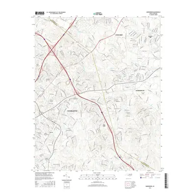
2016 Map of Harrisburg
USGS Topo · Published 2016About this map
The suburban expansion of Charlotte and Harrisburg defines this landscape, where modern infrastructure intersects with the deep-rooted history of the North Carolina Piedmont. The map highlights numerous burial sites that serve as anchors for local genealogy, including the Alexander Slave Cem and several congregational grounds like Newell Presbyterian Church Cem and Torrence Grove AME Zion Church Cem. This area is a significant educational and industrial hub, featuring the Univ of N Carolina at Charlotte campus and the industrial site of Roberta Mill.
Find a feature on this map
303 named features on this map. Tap any name to fly to it.
Don’t see what you’re looking for? This feature index may not catch every label — zoom into the map to look around manually.
Map Details
Editions of this 2016 Harrisburg Map
This is the sole edition of this map. No revisions or reprints were ever made.
Other maps of this area

1905 · Charlotte
USGS Topo · 1:48,000

1907 · Charlotte
USGS Topo · 1:62,500

1941 · Charlotte
USGS Topo · 1:125,000

1942 · Charlotte
USGS Topo · 1:125,000

1948 · Derita
USGS Topo · 1:24,000

1948 · Charlotte East
USGS Topo · 1:24,000

1949 · Kannapolis
USGS Topo · 1:24,000

1949 · Charlotte East
USGS Topo · 1:24,000

1949 · Harrisburg
USGS Topo · 1:24,000

1949 · Wilgrove
USGS Topo · 1:24,000