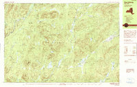
1990 Map of Harrisburg
USGS Topo · Published 1990About this map
The Sacandaga River and its East Branch carve through this portion of the Adirondack Park at the intersection of Warren, Hamilton, and Saratoga counties. The landscape is defined by its water systems, ranging from the high-elevation Wilcox Lake and New Lake to the broad Harrisburg Lake near the settlement of Harrisburg. The topography reveals a complex network of peaks like Georgia Mountain, Smith Mountain, and Wilcox Mountain, which influenced the development of small, isolated hamlets such as Bakertown and Griffin.
Find a feature on this map
62 named features on this map. Tap any name to fly to it.
Don’t see what you’re looking for? This feature index may not catch every label — zoom into the map to look around manually.
Map Details
Editions of this 1990 Harrisburg Map
This is the sole edition of this map. No revisions or reprints were ever made.
Other maps of this area

1895 · North Creek
USGS Topo · 1:62,500

1897 · North Creek
USGS Topo · 1:62,500

1898 · Thirteenth Lake
USGS Topo · 1:62,500

1899 · Indian Lake
USGS Topo · 1:62,500

1902 · Indian Lake
USGS Topo · 1:62,500

1903 · Luzerne
USGS Topo · 1:62,500

1907 · Lake Pleasant
USGS Topo · 1:62,500

1910 · Stony Creek
USGS Topo · 1:62,500

1950 · Glens Falls
USGS Topo · 1:250,000

1950 · Utica
USGS Topo · 1:250,000