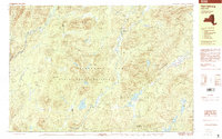
1997 Map of Harrisburg
USGS Topo · Published 2000About this map
Harrisburg and the surrounding high-country terrain of the Adirondacks are meticulously charted in this late-20th-century survey. The landscape is defined by the Adirondack Park State Forest Preserve and its complex hydrology, featuring the Sacandaga River to the west and East Stony Creek winding through the center. Small settlements like Bakertown, Fullers, and Knowelhurst appear as isolated clusters of human activity amid a sea of named peaks and ridges, such as Wilcox Mountain and Smith Mountain. The mapping reveals the specific local character of the woods, including Girards Sugarbush and Pine Orchard. Several remote water bodies like Wilcox Lake and Harrisburg Lake provide clear focal points for the drainage basins of Mud Creek and Jimmy Creek, while features like Auger Falls highlight the rapid elevation changes inherent in this portion of the State Forest Preserve.
Find a feature on this map
59 named features on this map. Tap any name to fly to it.
Don’t see what you’re looking for? This feature index may not catch every label — zoom into the map to look around manually.
Map Details
Editions of this 1997 Harrisburg Map
This is the sole edition of this map. No revisions or reprints were ever made.
Other maps of this area

1895 · North Creek
USGS Topo · 1:62,500

1897 · North Creek
USGS Topo · 1:62,500

1898 · Thirteenth Lake
USGS Topo · 1:62,500

1899 · Indian Lake
USGS Topo · 1:62,500

1902 · Indian Lake
USGS Topo · 1:62,500

1903 · Luzerne
USGS Topo · 1:62,500

1907 · Lake Pleasant
USGS Topo · 1:62,500

1910 · Stony Creek
USGS Topo · 1:62,500

1950 · Glens Falls
USGS Topo · 1:250,000

1950 · Utica
USGS Topo · 1:250,000