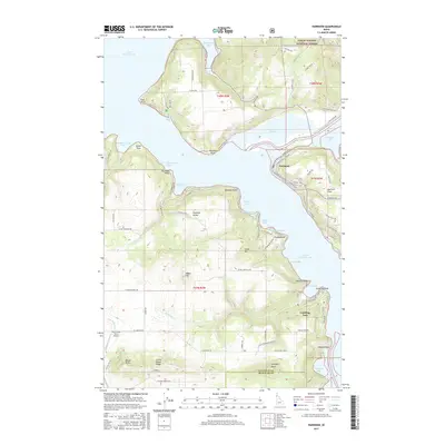
2017 Map of Harrison
USGS Topo · Published 2017About this map
Harrison occupies a prominent position on the eastern shore of Coeur d'Alene Lake, where the Coeur d'Alene River meets the lake's expansive waters. This 2017 survey details a landscape defined by dramatic shorelines and elevation changes, from the low-lying Harrison Slough and Anderson Lake to the high ground of Harrison Flats and Shoeffler Butte. The map illustrates the residential development along the lakefront, particularly at Conkling Park and Peaceful Valley, while the northern portion is largely dominated by the Coeur d'Alene National Forest.
Find a feature on this map
85 named features on this map. Tap any name to fly to it.
Don’t see what you’re looking for? This feature index may not catch every label — zoom into the map to look around manually.
Map Details
Editions of this 2017 Harrison Map
This is the sole edition of this map. No revisions or reprints were ever made.
Other maps of this area

1903 · Rathdrum
USGS Topo · 1:125,000

1955 · Spokane
USGS Topo · 1:250,000

1957 · St. Maries
USGS Topo · 1:62,500

1957 · Plummer
USGS Topo · 1:62,500

1957 · Coeur D'Alene
USGS Topo · 1:62,500

1957 · Lane
USGS Topo · 1:62,500

1958 · Spokane
USGS Topo · 1:250,000

1975 · Plummer NW
USGS Topo · 1:24,000

1975 · Plummer SE
USGS Topo · 1:24,000

1975 · Coeur D'Alene SE
USGS Topo · 1:24,000